


Last updated: October 27, 2026
From Hot Lava to a Flourishing Mountain Peak:
A Brief Look at the Origin and Transformation of Mount Waiʻaleʻale
Mount Waialeale (Waiʻaleʻale in Hawaiian) is the 5,148-foot volcanic summit in the center of Kauaʻi and one of the wettest spots on Earth. Its name means “rippling water,” and its rain feeds the island’s major rivers. Neighboring Kawaikini, at 5,243 feet, is the highest point on Kauaʻi.
| Mount Waiʻaleʻale at a Glance | |
| Location | Center of Kauaʻi, Hawaiʻi |
| Elevation | 5,148 feet (1,569 m) |
| Highest point on Kauaʻi | Kawaikini, 5,243 feet, just south of Waiʻaleʻale |
| Average rainfall | Roughly 400+ inches a year (estimates range from about 384 to 450, depending on the period measured) |
| Rainfall record | 666 inches in 1982 |
| Name meaning | “Rippling water” |
| Rivers it feeds | Waimea, Wailua, Makaweli and Hanapēpē |
| Summit access | No road. The historic eastern-ridge route is no longer accessible. |
Table sources: Britannica (elevation, Kawaikini, record, name, rivers); Weather Underground / C. Burt (rainfall range).
How the Mount Waialeale Volcano Formed
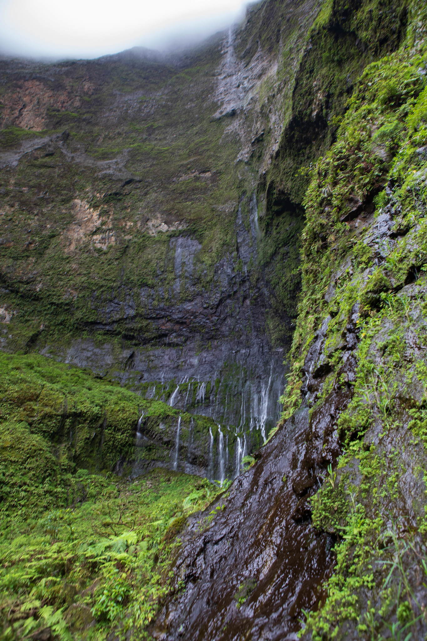
Deep below the ocean’s surface, in Hawaiʻi Nei, lies a story. It is one of friction, heat, volcanoes, lava, rock, and life. It all starts with the Pacific Plate, a massive tectonic plate that slowly slides across a fixed hotspot deep beneath the ocean.
At the hotspot, a plume of extremely hot magma rises through the plate and erupts on the seafloor. Over millions of years, those eruptions built the volcanoes that became the Hawaiian Islands.
While the hotspot below the Hawaiian Islands is fixed, the plate continues to move. Volcanic activity still occurs today on the Big Island of Hawaiʻi, the youngest island in the chain.
From Volcano to Canyons and Cliffs
Niʻihau and Kauaʻi are now past the shield stage of the growth of Hawaiian volcanoes, “when eruptive activity is frequent and the volcano rapidly builds above sea level.” As Niʻihau and Kauaʻi moved into the postshield stage, “volcanic activity starts to wane and erosion outpaces resurfacing by lava” resulting in the stunning canyons and cliffs you see today.
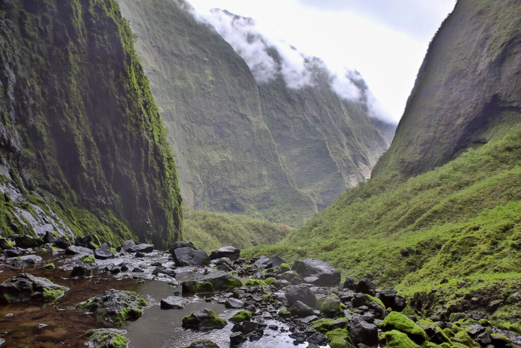
The towering Mount Waiʻaleʻale, located nearly smack dab in the center of beautiful Kauaʻi, is home to a plethora of awe-inspiring canyons and deeply carved cliffs born from this lava long ago.
Mount Waiʻaleʻale’s Ancient History & the Heiau of Kaʻawako
The ancient, sacred, waterfall-drenched caverns of Mount Waiʻaleʻale hold a deep cultural history drenched in ancient Hawaiian traditions. It was a place of pilgrimage and spiritual significance, a treacherous journey into the heart of Kauaʻi.
According to Hank Soboleski, author of Kauaʻi Island History parts 1 & 2 and longtime writer for the The Garden Island, “Long ago, Hawaiian chiefs and priests would climb Mount Waiʻaleʻale’s forbidding eastern face each year to the summit, where they would make offerings of flowers and wreaths and chant praises to their god Kāne at a small, stone heiau called Kaʻawako.”
Kāne is the head chief among the gods, the creator of sky and light, and the god of procreation in Hawaiian tradition. Hawaiians worship Kāne for giving life to humans and the realms of sun, dawn, and sky.
As you can imagine, this expedition was no small feat. The Hawaiian chiefs and priests began at the Wailua River. They traveled upstream by canoe until they could travel no more. From there, it was all up-mountain. Once they reached the base of the gigantic eastern-facing ridge, Hank Soboleski says,
[they’d] climb to its spine at about 2,300 feet, and make camp for the night. In the morning, they’d continue their ascent on a steep trail leading to a false summit named Pōhakupele, and onward to the northern end of Waiʻaleʻale’s summit, a steep, slippery, and treacherous route with fearsome drop-offs on either side.
Evidence shows that these magnificent hikes took place well into the mid-1800s when Hawaiians made the trek in clear conditions to view neighboring Oʻahu. In 1870, George Norton Wilcox successfully reached the summit with the help of Hawaiian guides. The last recorded climb up Mount Waiʻaleʻale’s steep eastern ridge was in 1874 by George Norton Wilcox (his second ascent), George Dole, and Fred Smith. About a century later, Valdemar Knudsen tried the climb, with helicopter pilot Jack Harter overhead in radio contact. He turned back near 3,000 feet because the terrain had become impassable.

Mount Waialeale Rainfall, Rivers and Kauaʻi’s Highest Point
The spiritual significance and spectacular draw of Mount Waiʻaleʻale are still strong to this day. While the eastern facing climb is no longer accessible, experienced hikers, who usually hike with someone who has already traversed the challenging path, continue to make the pilgrimage for a myriad of reasons: natural beauty, inspiration, spiritual connection, clarity, and pure excitement to name a few.
Today, the dark green, cloud-shrouded peak of Mount Waiʻaleʻale beckons hikers forth as it reaches high into the skies as if inviting the rain to fall heavily from the dense clouds above. And heavily, it falls. One must brave the rain for this adventure.
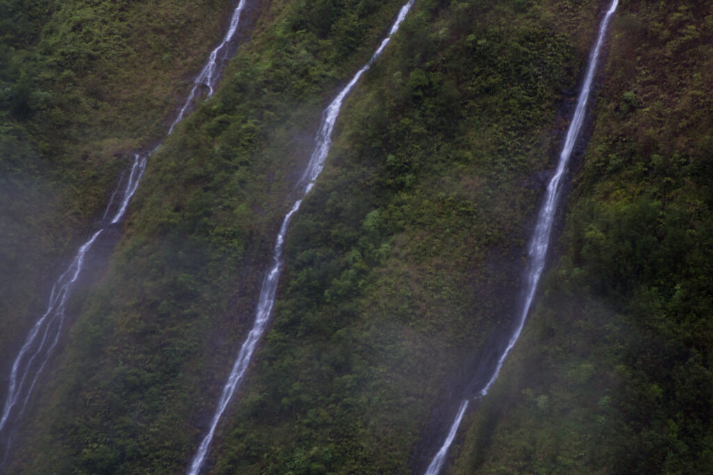
Standing 5,148 feet tall, Mount Waiʻaleʻale, meaning “rippling water” in Hawaiian, is one of the wettest spots on Earth. Britannica puts its average at about 450 inches a year. Long-term gauge records compiled by weather historian Christopher Burt put it closer to 384–423 inches, depending on the period. Either way, it’s a lot of rain. Rainfall from Mount Waiʻaleʻale feeds the only navigable rivers in all of Hawaiʻi: the Waimea, Wailua, Makaweli, and Hanapēpē.
On most days, the summit hides in cloud. When it clears, you can see why Hawaiians made the climb for generations: sheer green walls, dozens of waterfalls, and the rain that keeps Kauaʻi the Garden Island.
Waiʻaleʻale’s summit is a place few people ever stand. Kauaʻi’s wild side by water is a lot easier to reach. See our Nāpali Coast Snorkel Excursion or compare all Kauaʻi boat tours.
Can You Hike Mount Waialeale?
Not to the summit, at least not the way Hawaiian chiefs and priests once did. The historic eastern-ridge route is no longer accessible. Many visitors instead hike toward the “Weeping Wall,” the waterfall-streaked cliffs at the mountain’s base, but it’s a muddy, stream-crossing route in one of the rainiest places on Earth, and flash floods are a real risk. Trail access on Kauaʻi’s forest reserves can close after storms, so check the Hawaiʻi DLNR for current closures before you go, and never cross a rising stream.
Mount Waialeale FAQ
How tall is Mount Waialeale?
Mount Waialeale rises 5,148 feet (1,569 meters). It’s the second-highest point on Kauaʻi, after neighboring Kawaikini at 5,243 feet, which is part of the same central mountain mass.
What is the highest point on Kauaʻi?
Kawaikini, at 5,243 feet, is the highest point on Kauaʻi. It sits just south of Mount Waiʻaleʻale, and the two peaks share the island’s central volcanic summit.
Is Mount Waialeale the wettest spot on Earth?
It’s one of the wettest. Estimates of its average rainfall range from about 384 to 450 inches a year, depending on the period measured. Some places, including Big Bog on Maui, may be comparable or slightly wetter, depending on how the data are measured.
What does Waialeale mean?
Waialeale, written Waiʻaleʻale in Hawaiian, means “rippling water.” It’s a fitting name for a summit that receives some of the heaviest rainfall on the planet.
Can you see Mount Waialeale?
Clouds cover the summit most of the time, so clear views of the entire summit are rare. Its waterfall-lined walls are most often seen from the air on helicopter tours.
Sources
“A Chain of Islands: Hawaiian Hot Spot,” National Geographic
“How Did the Hawaiian Islands Form?” National Ocean Service
“Volcano Watch – A Geological Tour of the Hawaiian Islands: Kaua‘i and Ni‘hau,” USGS